 The Upper Watershed
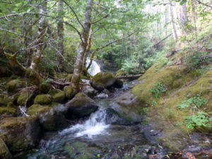
The upper portion of the Clackamas River watershed contains about 445,000 acres of land, which is 74% of the total watershed. Most of this land is in the Mt. Hood National Forest, managed by the USDA Forest Service. The upper watershed’s streams and rivers are fairly steep and fast moving with narrow floodplains and few side channels. There are almost no permanent human settlements in the upper watershed, and the area has largely been managed for forestry, conservation, and recreation. Additionally, much of the terrain is steep and somewhat remote. As a result, the forests, streams, and other habitats of the upper watershed are quite healthy with relatively few invasive weeds. This is great news!
The Problem
Weed seeds or plant parts can spread to remote areas through recreationists, road maintenance equipment, and animals. Because these areas are remote, the concern is that an invasive weed patch could go undetected for years and become a big problem. For example, an abandoned rock quarry or decommissioned road can contain invasive weeds because seeds were accidentally brought to the area on dirty equipment. Then, because people rarely visit these places, those weeds can grow and reproduce without detection.
If these invasive weed populations are left unchecked, they can spread and dominate some areas, thus reducing plant diversity, decreasing the quality of habitat and forage, and potentially out-competing some of our rare and sensitive species.
While we are concerned about many invasive plants, we are most concerned about weeds that can grow well in forest understories, such as false brome and garlic mustard. There are also many invasive plants that spread easily along trails and roadsides. This can be a problem because the vehicles, hikers, and animals that use these roads and trails can unknowingly spread seeds or other reproductive plant parts.
What are we doing?
To combat this problem, the Clackamas River Invasive Species Partnership (CRISP) has decided to conduct extensive surveys of the upper watershed. Since 2017, we have surveyed 373 locations in the upper watershed, targeting 67 invasive weeds. These locations included trailheads, campgrounds, quarries, decommissioned roads, construction sites, illegal dumping sites, and the entire Road 45 system. We were also able to assess weed patches that had been previously recorded and needed an update. In addition to invasive weeds, we also looked for rare, threatened, and endangered species. This helps us to be aware of any sensitive species in the area when we return to control the weeds.
These surveys are giving us valuable information! In particular, we were able to find and control previously undetected patches of false brome, a high priority weed. Additionally, we have recorded and treated patches of houndstongue, knotweed, knapweeds, rush skeleton weed, common hawkweed, European hawkweed, black locaust, goutweed, and others. The WeedWise program has been working closely with the USDA Forest Service, the Oregon Department of Agriculture, and Portland General Electric to control the most impactful weeds and prevent them from spreading.
What’s next?
We are planning to continue these surveys and treatments as long as we can. Each year, we seek to survey a new area that we have never surveyed. These surveys continue to inform our decisions about which plants and locations we will target each year.
This project gives us the information we need to detect and prevent the spread of invasive weeds and protect these high quality habitats.


